When will the Parkway’s leaves stop producing chlorophyll and change to their wardrobe of fall colors? If you’re wondering when the peak Blue Ridge Parkway Fall leaf season will be this year, you’re not alone. It’s usually in October which is often the busiest month along the Parkway. But there are many factors that influence the timing and intensity of the color, including when and how much rain falls, how late in the season the sun shines with intense heat, and how cool the nights are. So your best bet to see Fall color is to incorporate as many of these elements into your trip as possible:
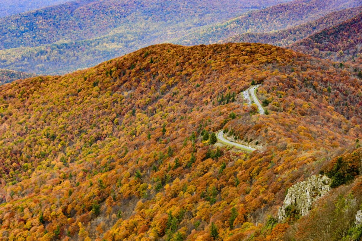
Elevation: Travel a longer section of the Parkway to see a variety of elevations. Leaves change color at higher, cooler elevations first. The elevation along the Parkway ranges from over 6,000 feet at Richland Balsam in North Carolina to just under 650 feet at the James River in Virginia. You can also continue into Shenandoah and Great Smoky Mountains National Parks on either end of the Parkway for additional opportunities to view fall color. Clingmans Dome in Great Smoky Mountains National Park is the state high point of Tennessee and Mount Mitchell, located along the Parkway at Milepost 355, is the state high point for North Carolina and either would be a good choice.
Aspect: Which direction a slope faces determines its temperature and the type of plants that grow there. Leaves change color first on cooler, wetter north-facing slopes and later on warmer, south-facing slopes. View a variety of aspects to see different plants and different phases of color change.
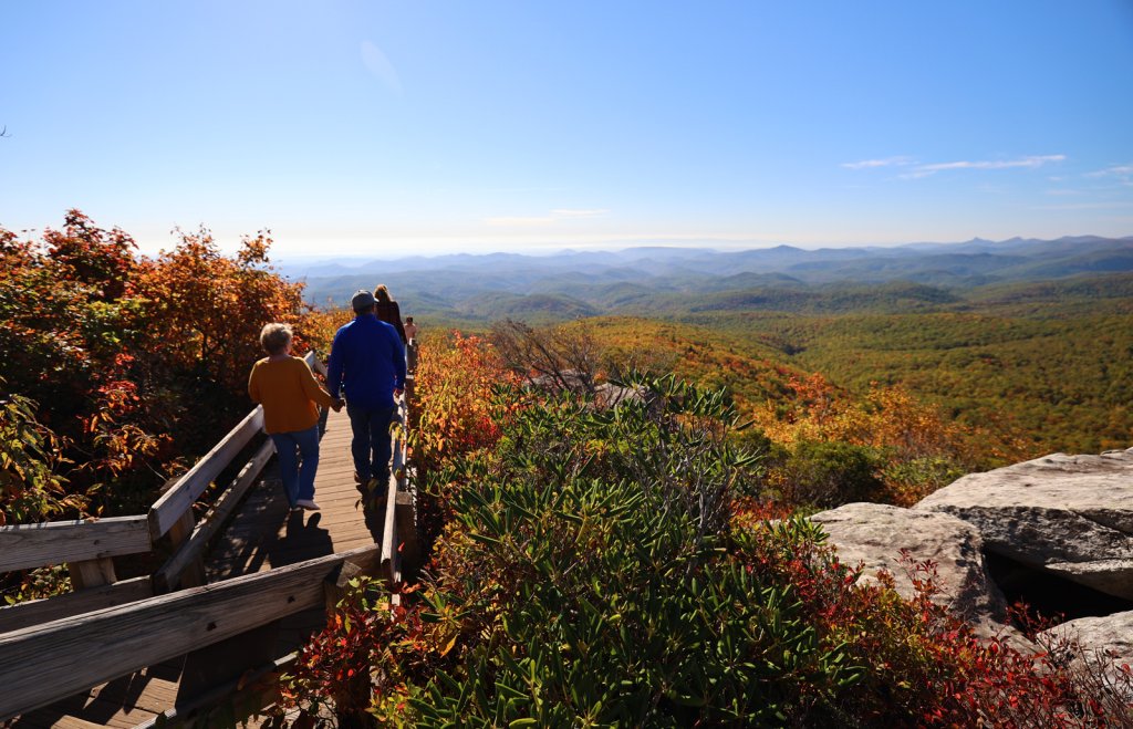
Distance: Overlooks with distant views reveal a variety of elevations and aspects so you are more likely to see leaf color. Clingmans Dome in Great Smoky Mountains National Park is the state high point of Tennessee, and Mount Mitchell, with access at Parkway at Milepost 355, is the state high point for North Carolina; either would provide a long distance view. But many Parkway overlooks also provide long-range views, so there are lots of options beside the tallest peak in the state.
The bottom line is, don’t expect to pick one spot on one day on the Parkway and see the perfect cacophony of color–instead, travel a longer distance and you’re likely to meet all the criteria above and see a variety of stages of color change.
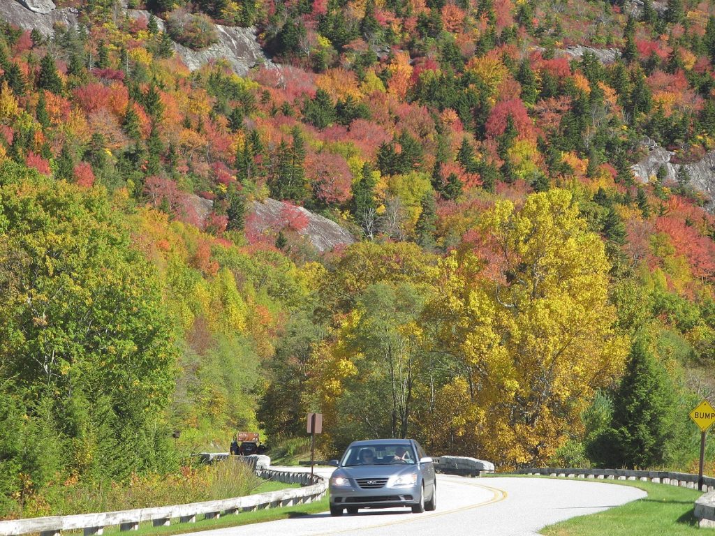
Here is the general progression:
- Leaves at the highest elevations (Clingmans Dome, Grandfather Mountain, Sugar Mountain, Mt. Mitchell, and Waterrock Knob) change in late September/ early October.
- Mid-October provides good color along most of the Parkway and Great Smoky Mountains National Park, including Boone and Blowing Rock in NC and Wytheville and Fancy Gap in VA.
- Next, the lower elevations provide good color (Pisgah National Forest, Linville Gorge, Nantahala Gorge and Maggie Valley in NC and Roanoke, Lynchburg, Lexington, Waynesboro and Shenandoah National Park in VA).
- The lowest elevations (Asheville, Brevard, Waynesville, Cherokee, Gatlinburg, Chimney Rock, and Lake Lure) provide the final color display if the weather has cooperated and there are still leaves on the trees.
If you want to see this progression visually, there are some excellent resources online:
- Fall color forecast for the mountains of North Carolina
- A scientific opinion from Appalachian State University in Boone, NC and a visual representation
- Blowing Rock, NC foliage updates
- Asheville, NC interactive fall color map notes areas of interest at different elevations
- The Virginia Department of Forestry offers typical timeframes for peak color
- And the Fall Foliage Prediction Map visually depicts the color change across the entire United States by county and by week.
Some things to remember about Parkway travel this Fall:
- The Parkway’s unique features such as limited sight distances, blind curves and elevation changes, offer driving challenges. Please stay alert and watch for other motorists, wildlife, and bicyclists!
- Make advance reservations for lodging. Our interactive map visually shows where lodging is located along the Parkway. Check out Blowing Rock, NC for a variety of lodging options, fall events and activities and long-range mountain views.
- Expect a closure by Roanoke, VA due to a serious slope failure there. You can take US 221 around the closure from Parkway Milepost 135.9 to Milepost 106 (about a 27-mile detour). Visit Virginia’s Blue Ridge has prepared a set of turn-by-turn detour instructions to help visitors enjoy Roanoke. Review the daily-updated NPS road closure chart for details on current Parkway road closures.
- Confirm that a location is open before visiting—not every visitor center is open every year and some have modified hours and services. Visit the NPS Operating Hours and Seasons page for details.
- Utilize our website and interactive map for identifying the access points and planning your drive along the Parkway.
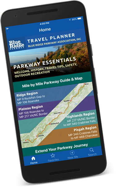
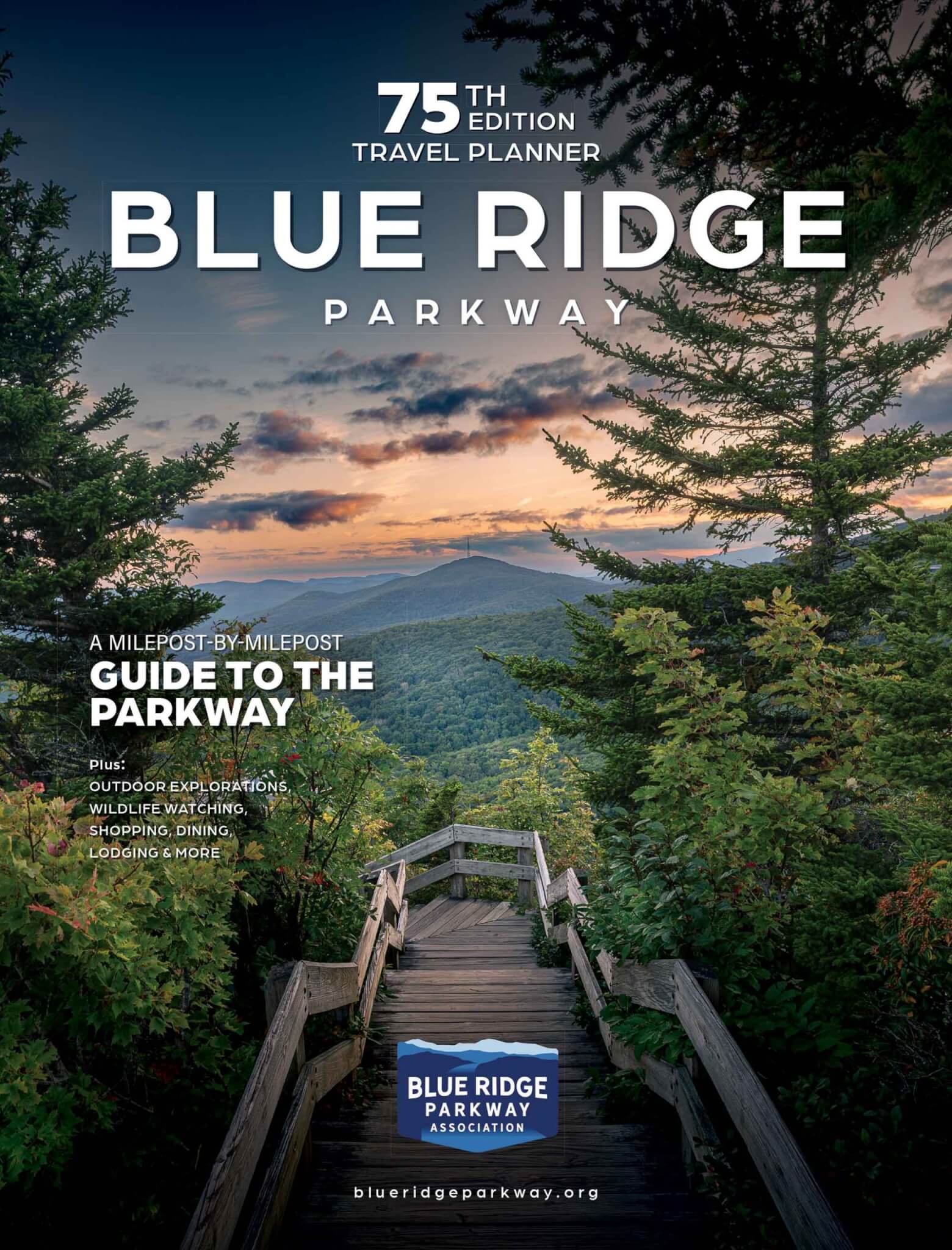
- Use a our Blue Ridge Parkway Travel Planner and Map for milepost-by-milepost travel info and maps by region before and during your trip. AAA members can request a copy from AAA, you can request one from BRPA, or you can pick one up at a regional or Parkway visitor center. Or, just save the digital version on your device and you’ll always have it with you!
- Download our Blue Ridge Parkway Travel Planner mobile app for use with or without cell phone coverage.
- Peruse our Events Calendar to find out what’s happening along the Parkway during your trip. Find a local orchard, farm or market or a suggested itinerary to help make the most of your travels.
- Check out our Fall color page for foliage resources and regional information.