About the Blue Ridge Parkway
The Blue Ridge Parkway is the longest linear park in the U.S., spanning 469 miles of scenic beauty and connecting Skyline Drive in Virginia’s Shenandoah National Park to Great Smoky Mountains National Park in North Carolina. The Parkway serves as a gateway to northern and southern Appalachia. With multiple access points and no entry fee, the Blue Ridge Parkway is designed to be explored. Plan your trip to experience this beautiful Scenic Byway, and discover all the wildlife and adventure waiting for you on (and off) the Parkway.
Blue Ridge Parkway FAQ
Do you have questions about the Parkway? We have the answers! Find out when the Blue Ridge Parkway is open, what time to visit, and where to stop with our Frequently Asked Questions.
Where does the Blue Ridge Parkway start and end?
The Blue Ridge Parkway connects Shenandoah National Park to the Great Smoky Mountains National Park, stretching 469 miles from Rockfish Gap, VA, to Cherokee, NC. Visitors can see the route and the many access points on our interactive map.
How do I get to the Parkway?
You can enter the North Entrance or South End of the Blue Ridge Parkway into navigation apps to reach either end of the Parkway. Since the Parkway is a slower, scenic route, apps won’t automatically direct you along it. You’ll need to follow directional signage along the Parkway once you arrive. Use the Blue Ridge Parkway Travel Planner App for official maps and resources!
Where can I find the latest information on Parkway detours and closings?
The most up-to-date closing information about the Blue Ridge Parkway can be accessed on the NPS closure chart.
When are Visitor Centers, campgrounds and Parkway facilities open?
Parkway Visitor Centers, campgrounds, and facilities are open seasonally. Facilities that are generally open year-round are: the Museum of NC Minerals, the Folk Art Center and the Blue Ridge Parkway Visitor Center in Asheville, NC.
Where can I get information and brochures about traveling on the Parkway?
The Blue Ridge Parkway Association provides complimentary Parkway brochures. The Blue Ridge Parkway Travel Planner and the Blue Ridge Parkway Map are available to download or print.
NPS Photo
Explore Blue Ridge Parkway Shops & Gifts
Get your Parkway keepsake at visitor center gift shops, discover handmade artisan goods at the Folk Art Center, or uncover Appalachian antiques in nearby Parkway towns.
History of the Blue Ridge Parkway
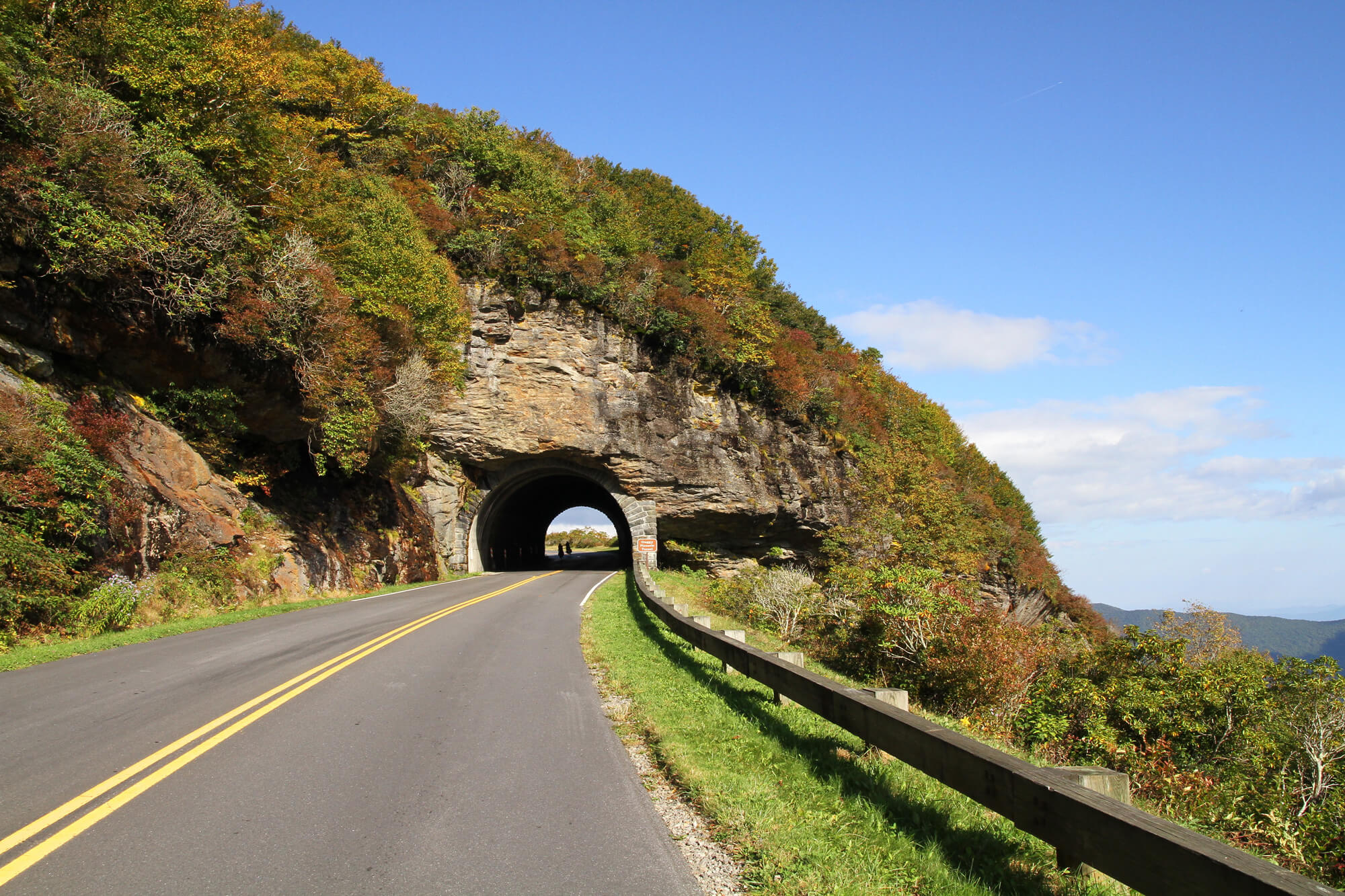
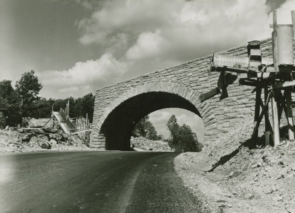
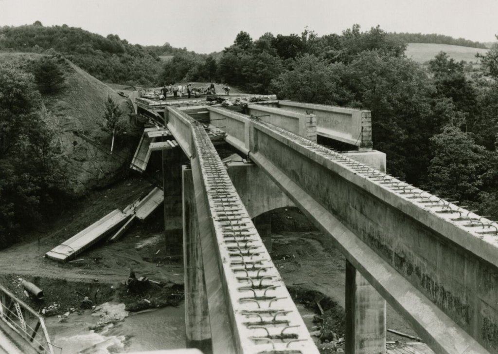
The Blue Ridge Parkway started to take shape in 1935 when President Franklin D. Roosevelt approved plans for the Parkway as part of New Deal programs to help the region through the Great Depression. In 1936, the Parkway became part of the National Park Service (NPS) and was designated as a National Scenic Byway in recognition of its historic, natural, and scenic qualities. Fifty-two years after the project started, the Linn Cove Viaduct was the last piece of the Parkway constructed and was completed in 1987. Slow down and notice the details of stonework laid by the original stonemasons, man-made vertical rockfaces, and the 26 original tunnels providing passage through the mountain ridge. Don’t forget to get off the Parkway and into the local towns to discover more Appalachian history and take a trip through time on your Parkway journey.
Support the Parkway
You can get involved today! Become a Blue Ridge Parkway Association (BRPA) member to take advantage of special member benefits, support our partner organizations, and always practice sustainable tourism along the Parkway.
Healthy Treats for Adventure Dogs
Zuke’s is committed to protecting
the places dogs and their people
love to explore.

DOWNLOAD THE APP
Use our new app as a guide to help make your drive on the Parkway a safe and fun one.
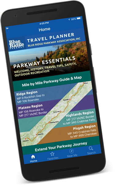
DOWNLOAD THE TRAVEL PLANNER
Map out your Parkway trip with a digital version of our complimentary travel guide.